 |
|
|
 Technology News | June 2007 Technology News | June 2007 
Snapshots That Do More Than Bore Friends
 Michelle Higgins - NYTimes Michelle Higgins - NYTimes
| | (Peter Arkle) |
Few sentences in the English language are more dreaded than this seemingly innocent offer: “Oh, I must show you the pictures from my vacation.” Who wants to see endless shots of a friend lounging by a pool or in front of a monument, or — worse yet — their kids doing the very same things?
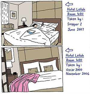
But, of course, those very same shots can be extremely useful when researching your own trip. How big is that pool? What, exactly, does the room at that five-star hotel you’re thinking of booking look like? What’s the crowd like at the so-called hot restaurant? It’s good to have documented evidence from someone who has been there.
And recently, photo-sharing sites like Yahoo’s Flickr.com and SmugMug.com have begun to let users add another dimension to their travel photos. Through a technology called geotagging, users can add G.P.S. data to their pictures, which can then be plotted on a digital map. This not only allows users to see exactly where a photo was taken, but, when uploaded to an Internet map, users can also quickly browse a trove of photos that were taken nearby, providing a kind of scattershot collage of a place.
For example, people planning a trip to Cancún can use Google Earth, a free mapping software, to zoom in on Cancún’s crowded hotel zone and click on dozens of candid photographs, from the lounge chairs at the Fiesta Americana Grand Coral Beach hotel and the pool at the Omni Hotel & Villas, to snapshots of less-crowded beaches and the nearest mall.
Plotting photos on maps also allows trip planners to “see” the terrain before booking a trip. On Everytrail.com — which lets users upload geocoded photos from their favorite hiking trails, biking routes and sailing trips — visitors can check out sights along a specific driving route in Namibia, or examine trail conditions on a hilly bike route near Palo Alto, Calif.
But it’s the odd juxtapositions of randomly plotted photos that may be the most surprising — and useful — to travelers with more obscure interests. For example, fans of graffiti can search the word, “graffiti,” and “New York City,” at Flickr.com/map, and pull up photos of freshly painted tags, all plotted with pushpins on a clickable Yahoo map. A search for “Dumbo Brooklyn graffiti,” for example, finds some 99 photos, including the infamous “Neck Face” tag, spray-painted on a brick warehouse at Jay and Front Streets in Brooklyn. Try finding that in a guidebook.
Geotagging photos brings a whole new level of context to the image, said Andy Williams, general manager of SmugMug.com, a photo-sharing site. “After all,” he said, “pictures are flat.” But the real reason geotagging is getting so popular, he added, are the bragging rights involved. “We want people to know the cool places we’ve been,” he said. “And this is a cool way to show off.”
The steps needed to geotag photos are admittedly somewhat geeky. At photo-sharing sites like Flickr and SmugMug, most users must first upload their photos and then plug in the address or manually plot each image on a map, which can require lots of zooming in, recentering and dragging, before a photo is placed on the desired coordinates.
To streamline the process, several camera makers have released models that are G.P.S.-ready, with either a built-in device or a special accessory. But they tend to be geared toward professionals and are expensive. The Nikon D2X, the company’s current top-of-the-line SLR model ($5,100), works with an optional MC-35 GPS Adapter cord ($139) that connects with a standard G.P.S. receiver (which you must also buy) to automatically save location coordinates with each photograph.
But G.P.S. is starting to show up among lower-priced cameras. The new Ricoh 500SE (about $1,000), a point-and-shoot model aimed at outdoor enthusiasts, has a built-in G.P.S. device. It’s even showing up on camera phones, including the Nokia N95, though the $749 price is still a bit steep.
Once your photos are plotted geographically, others can discover a place through your travels.
In 2005, John and September Highman quit their jobs, took their son and daughter out of school and traveled the world, visiting 28 countries and 5 continents in 52 weeks. Mr. Highman chronicled their adventures on SmugMug (at higham.smugmug.com), mainly to store photos and allow friends back home to track their progress. The project soon drew a following when others stumbled upon their photos and asked to be added to Mr. Highman’s distribution list. Now, he is working on a book, “Armageddon Pills,” that ties together his Web site and geotagged photos.
Web sites are increasingly embracing geotagging as a way to draw users. Last month, Google announced plans to acquire Panoramio.com, a photo-sharing site with more than two million images that allows users to integrate photos into Google Earth. And as photo-sharing continues to evolve, travel Web sites are recognizing how valuable images can be when users essentially act as free contributors and submit their own pictures.
Zoomandgo.com, a travel review site, recently redesigned its site around photos and videos submitted by travelers. A team of four people spent months “geocoding” thousands of hotels and attractions so that user-photos can be displayed on digital maps. A new social-networking feature also allows users to create their own travel profiles, connect with like-minded travelers, and swap tips through photos.
“Facebook meets Frommers” is how Jonathan Haldane, the founder of Zoomandgo.com, described it. Before the social-networking feature went up, he said, users spent about eight minutes on the site, mostly reading or posting hotel reviews. Now, he said, users spend an average of 18 to 19 minutes, sending messages to each other and browsing through photos and videos.
But though travel sites are embracing the flood of user-generated photos, the quality can vary. A Flickr search for the W hotel in New York City, for example, turns up a mix of candid room photos and pictures of friends eating pizza. To wade through the clutter, Stewart Butterfield, general manager for Flickr, suggests adding the words “not portrait” or “not family” in your search to weed out cheesy tourist snapshots.
Zoomandgo.com, which pays users a nominal fee for relevant photos, says it vets every submission. The site says, “As a result, you won’t see any pictures of your Aunt Sally posing outside her house (Sorry, Aunt Sally), or any videos of your neighbor’s dog Yoda peeing on a tree (Sorry, Yoda).”
Panoramio, on the other hand, has a devoted online community that tends to self-edit, and post photos only of places rather than people. “If you’re wanting to see photos to plan your trip, you’re not necessarily wanting to see a couple’s wedding photos on their beach in Maui,” said John Hanke, director of Google Earth and Maps, “You want to see the beach in focus.” |
| |
|

